El Trole / Los Trolebuses de
The Trolleybus System of
QUITO, ECUADOR
BY
Allen Morrison
Part 1: Intro, Av. 10 de Agosto [Go to Part 2: Centro, Av. Maldonado]
This website, divided into four parts [see above], charts the development of the Quito line geographically and chronologically, from its beginnings at Estación Norte in 1995 to the new southern terminal opened at Quitumbe in 2008 and the new northern terminal, El Labrador, in 2018. There are 62 illustrations and a system map.
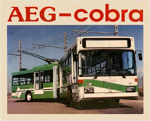
Quito sprawls along a north-south valley about 25 km long and 5 km wide, not far from the "Mitad del Mundo" (Middle of the World) monument on the Equator. Altitude is 2,850 m. Pichincha Volcano looms over the city at 4,794 m and Chimborazo nearby reaches 6,310 m. Because of its remote location, altitude and steep streets, the ancient Inca capital never had an animal-powered tram system. The arrival of a steam railroad in 1908 produced a need for public transport between its terminal, on a hill south of town, and the commercial area north of the Machángara River [see map]. The electric tramway that opened in 1914 ran until 1948 [see The Tramways of Quito]. The trolleybus line built a half century later duplicates its route. When the city's population reached a million in 1990, hundreds of small buses were inching along its streets, spewing black smoke. Construction of a modern rapid transit rail line, heavy or light, was rejected because of cost and the fragile condition of colonial buildings in the Centro Histórico, which had been declared a World Heritage Site by UNESCO in 1978. In January 1992 the municipal government announced a Plan Maestro that would divert hundreds of bus services from the city center to new intermodal terminals north and south, and replace all gas or diesel buses on Avenidas 10 de Agosto and Maldonado with electric trolleybuses running in reserved lanes (an arrangement used successfully in Curitiba and São Paulo, Brazil). In September 1994 Quito signed a $57 million contract with the German-Spanish consortium AEG-Cobra for the construction of an 11.2 km trolleybus line and 54 articulated vehicles. The latter, numbered 01-54, were assembled by Hispano Carrocera in Zaragoza, Spain, had electric motors by AEG, chassis and auxiliary diesel motors by Mercedes-Benz and electronic control by Kiepe Elektrik of Germany. The prototype, shown below, was 17.8 m long, 2.5 m wide and 3.6 m high, and could carry 176 passengers.
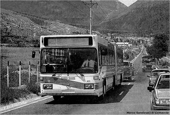
See Kiepe Elektrik document (text in German and Spanish). Trolleybus number 01 arrived at Guayaquil, Ecuador's chief port, on 20 October 1995. Using its diesel motors, it was driven 420 km to Quito on 24 October 1995. [Marco Sandoval, El Comercio, Quito, 29/10/1995]
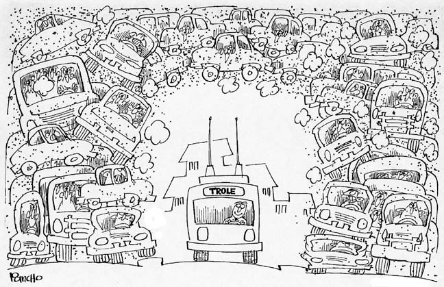
Thirteen more trolleybuses arrived in early December at Esmeraldas, a port on Ecuador's north coast. On 18 December 1995 the Unidad Operadora del Sistema Trolebús ("UOST"), which had been created in November, began providing free rides to passengers over 4.5 km of the line, from Estación Sur to the parada called Plaza del Teatro [see map]. This cartoon, published in a Quito newspaper on 26 December, showed Quiteños their new Christmas present. [El Comercio, Quito, 26/12/1995]
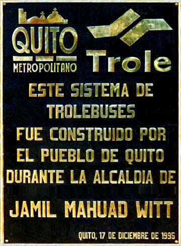
Revenue service along that section began on 8 January 1996 and, as more vehicles arrived, the line was extended to Parada Colón on 19 March [see map]. Finally, on 21 April 1996, 54 trolleybuses began carrying passengers on the entire 11.2 km route, from Estación Sur to Estación Norte. Including the terminal stations and 20 paradas, construction had been completed in an amazing 19 months. The plaque was photographed at Estación Sur: "This trolleybus system was built by the people of Quito during the mayoralty of Jamil Mahuad Witt". The line's popularity was one of the reasons that Mayor Mahuad was elected President of Ecuador in 1998. [AM]
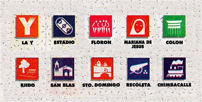
The floors of Quito trolleybuses are 65 cm above the ground and passengers board and disembark on platforms in the estaciones (terminal stations) and paradas (stops) along the route [see map]. They pay fares before they enter the platform areas, so loading and unloading are quick. Here are samples of parada names and symbols. Parada Chimbacalle serves the Guayaquil & Quito Railway station. [El Comercio, Quito, 21/4/1996]
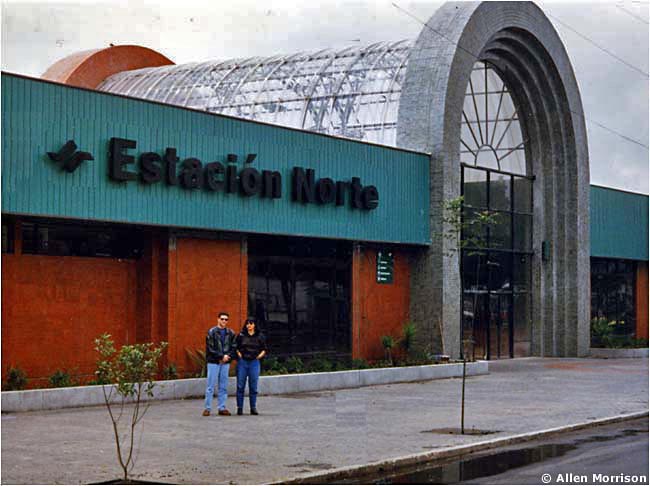
Estación Norte and Estación Sur were the original termini of the trolleybus line [see map]. But since 1995 the line has been extended, other intermodal bus stations have been built beyond these points, and the old terminals have been renamed Estación Norte La "Y" and Estación Sur El Recreo. On bus destination boards the stations are called simply La "Y" and El Recreo. (La "Y is a Y-shaped intersection that has lent its name to the entire region and El Recreo is the name of the southern district. The trolleybus line also has a Parada La "Y"!) Hereafter, on this website, these stations will be referred to as Estación La "Y" and Estación El Recreo. The photograph shows the entrance to Estación La "Y", where passengers change to/from trolleybuses and diesel buses that serve the northern districts of the city. [AM]
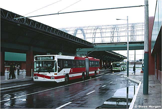
The loading platform at Estación La "Y" after a shower in October 1996. Quito trolleybuses are painted white with trim in either red, yellow, light green, dark green, light blue or dark blue. The destination board shows the fleet number and the inscription "Municipio del Distrito Metropolitano de Quito". Fleet numbers are also painted on both sides and the back. A card in the front window specifies the circuito – the section of the line where the trolleybus will run. This photograph shows red trolleybus 12 and light green trolleybus 07. [Steve Morgan]
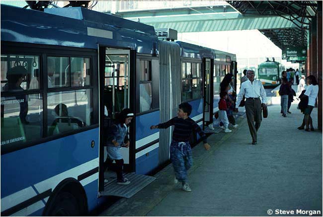
Passengers alighting from trolleybus number 39 at Estación La "Y". Quito trolleybuses pioneered the use of "bridgeplates" – steel plates in their doorways that fold down at stations to bridge the gap between the vehicle and the platform. The trolleybuses in Mérida, Venezuela, adopted this feature in 2003. [Steve Morgan]
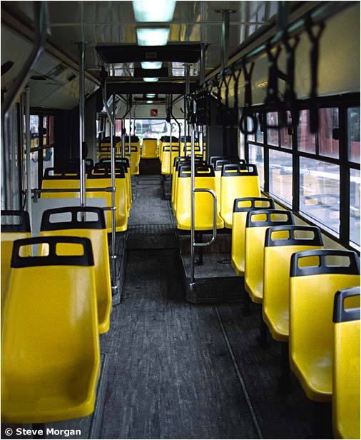
Interior of dark blue trolleybus 23 (the fleet number is visible, reversed, in the rear window). [Steve Morgan]
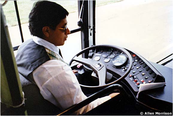
Quito trolleybus driver, March 1996. Note tie and plaid vest. [AM]
A beautiful view of trolleybus 06 arriving at Estación La "Y" in October 1996 [see map]. It has just turned off Av. 10 de Agosto in the background. The new building on the right has flats en venta (for sale)! [Steve Morgan]
|

Av.
10 de Agosto eleven years later, in October 2007. Since 1996 the
foliage has grown, the pavement has worn and Quito trolleybuses have
carried 700 million passengers. Number 22 has stopped at Parada La "Y" [see map]. It has a yellow circuito sign in its front window and is traveling south. The photographer was facing north. [Peter Haseldine] |

Another view of Av. 10 de Agosto in October 2007. Camera is pointed south. Northbound trolleybus 07 has just left Parada Mariscal in the distance [see map]. [Peter Haseldine]
Trolleybus 12 traveling north on Av. 10 de Agosto, near Parada Mariana de Jesús [see map]. Is it a reflection, or has some of the vehicle's red paint faded? The view is south, in October 2007. [Peter Haseldine]
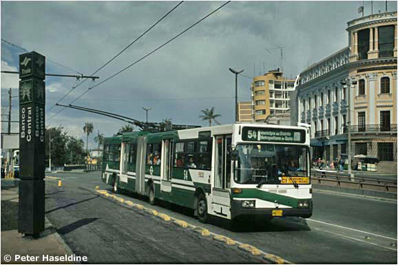
Trolleybuses stop at the paradas every 1-2 minutes and their weight and heat take a toll. Number 54 is bypassing Parada Banco Central while its usual path is resurfaced [see map]. It will stop at a makeshift platform nearby. View is north in October 2007. [Peter Haseldine]
There are three busy intersections on Av. 10 de Agosto where trolleybuses pass below. Originally there was alternate wiring also on the streets above, but this seems now to have been removed. Number 30 was photographed in October 1996 at Plaza Sebastián de Benalcázar, just south of Estación La "Y" [see map]. [Steve Morgan]
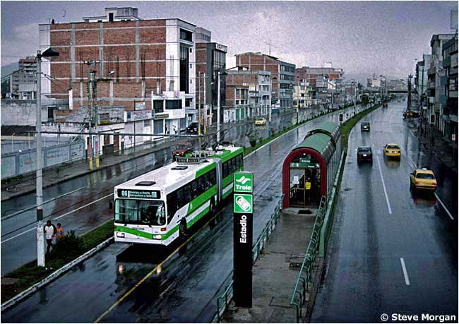
Av. 10 de Agosto on a rainy day in October 1996. View is south. Northbound trolleybus 06 is passing southbound Parada Estadio [see map]. Note both parada name and symbol on the post. The small structures in this area have been replaced by larger buildings today. [Steve Morgan]
Most of the paradas along Av. 10 de Agosto are staggered, spaced a half block or so apart, so as not to "rob" too much space from automobiles. But in a few cases both northbound and southbound paradas are exactly opposite. This photograph of Parada Santa Clara was taken in March 1996 [see map]. Note the crosswalk. The view is north. [AM]
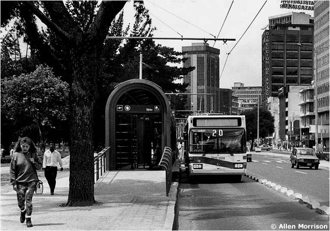
Toward the south end of Av. 10 de Agosto the trolleybus lanes and paradas are along the curb, rather than in the center of the street. Here is Parada Ejido, next to Parque El Ejido, in March 1996 [see map]. View is south. Note concrete blocks bordering the trolleybus lane. The southbound trolleybus lane and parada are on the other side of the avenue. [AM]
To move between curb and center lanes trolleybuses must share space with other vehicles. Number 14 has left Parada Ejido in the distance – see previous view – and is crossing to the center of Av. 10 de Agosto to join the southbound lane. The southbound blue trolleybus on the right is doing the opposite [see map]. View is south. Parque El Ejido is on the left. Quito's Centro Histórico is straight ahead . . . [AM]
Continue to Part 2: Centro, Av. Maldonado Go to Part 3: "Trolesur", Quitumbe Go to Part 4: "El Trolebús", El Labrador |
–––––––––––––––––––––––––––––––
See my index of
ELECTRIC TRANSPORT IN LATIN AMERICA
If you have comments, criticism or suggestions,
please write to Allen Morrison! Leo y escribo español.
This site was placed online on
14 March 2009
Copyright © 2009-2109 Allen Morrison
ALL RIGHTS RESERVED
TODOS LOS DERECHOS RESERVADOS
