
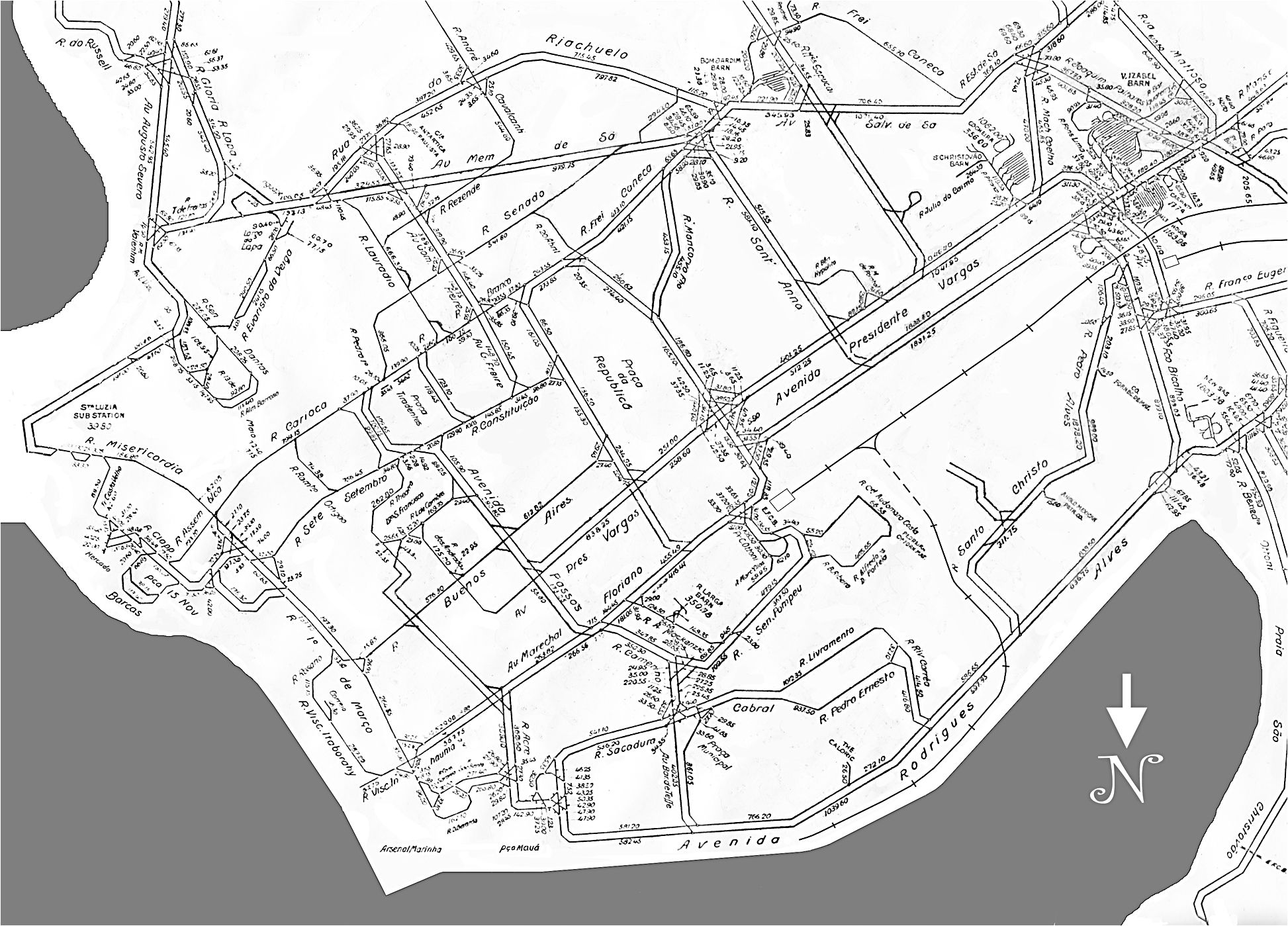
This map is undated and shows only track layout in the center of the city. It was issued by RJTL&P probably about 1960 and is upside down – north is at the bottom, the reverse of most maps today. Tram lines that closed before 1960 are not shown. The Santa Teresa system was running in 1960, but is not shown because it was not operated by RJTL&P. To see a map of the new Veículo Leve sobre Trilhos system – with north at the top – go to RIO DE JANEIRO Light Rail / VLT.
Este mapa não tem data e mostra apenas os trilhos no centro da cidade. Foi emitido pela RJTL&P provavelmente cerca de 1960 e é de cabeça para baixo – o norte está na parte inferior, o inverso da maioria dos mapas de hoje. As linhas de bonde que fecharam antes de 1960 não são mostrados. O sistema de Santa Teresa existia em 1960, mas não é mostrado porque não foi operado pela RJTL&P. Para ver um mapa do novo sistema do Veículo Leve sobre Trilhos – com o norte no topo – ir ao RIO DE JANEIRO Light Rail / VLT. Webpage by Allen Morrison |